A change in the way river maintenance material is managed
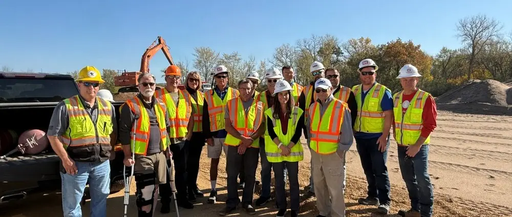
In a 28 October 2026 announcement, the US Army Corps of Engineers' St. Paul District confirmed that operations had begun under an agreement with the city of Wabasha and its Port Authority in Minnesota. The partnership concerns the handling of sand removed during navigation maintenance on the Upper Mississippi River. Rather than organize all of the subsequent transport to final placement sites through its own contracts, the Corps will compensate the city for taking responsibility for the material under an arrangement made pursuant to Section 217 of the Water Resources Development Act. Representatives of the participating organizations marked the first removal of material on 13 October. This is not an announcement of new yacht-berthing capacity or a completed channel survey. Its significance for owners who cruise the inland waterways of North America is that the maintenance of established navigation routes relies on the ability to deal with large volumes of sediment long after it has been lifted from the river.
A nine-foot channel and the requirements of different vessels
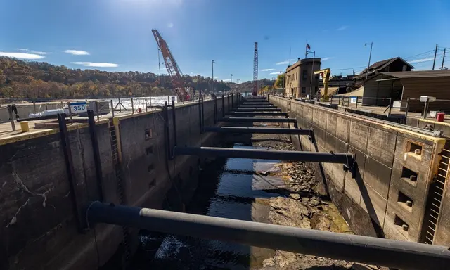
The Corps maintains a congressionally authorized nine-foot channel through this part of the Upper Mississippi. Its principal role is to facilitate the movement of commercial barges carrying agricultural products and other bulk cargoes, but the route is also of interest to recreational operators travelling between inland destinations. An authorized channel dimension is a description of the federal navigation project's intended characteristics, not a measurement of available water under every point along a boat's intended route. Even on a charted channel, the actual assessment of clearance depends on the relevant water level, survey information, vessel dimensions and operating conditions. A yacht approaching a local facility may leave the maintained channel before reaching the assigned berth. Captains must investigate that part of the route separately. For an owner considering an eighteen-metre displacement motor yacht for inland cruising, the fact that a much larger commercial vessel operates in the region does not answer the question of whether the yacht can use a particular basin, lock approach or private slip. The requirements and arrangements must be confirmed for the actual vessel.
The scale of annual sediment handling
The district reports that its maintenance work normally removes about 250,000 cubic yards of sand each year in Lower Pool 4 and the Wabasha reaches. That volume represents approximately one quarter of the district's annual navigation dredging needs. The figures explain why decisions about the subsequent handling of dredged material matter at a regional scale. Removing sediment from a channel is only one stage in a larger sequence of operations. If an agreed temporary placement area has no adequate remaining capacity, the practical options for a subsequent dredging campaign may become constrained. Material must be transported, stored or placed under suitable arrangements, taking account of its characteristics and the requirements governing the destination. The challenge is especially important where channel maintenance is recurrent rather than a single capital project. The Corps' report does not state that all sand removed from the river can be used for every construction purpose, nor does it provide an assessment of current channel conditions. It identifies a particular mechanism for making the recurring operation more sustainable in logistical terms.
A different division of responsibility
The Section 217 agreement is described by the Corps as the first inland-waterway partnership of this kind in the United States. The negotiated payment to the local authority is intended to replace the need for certain conventional federal long-distance transport contracts. The city, acting through its Port Authority, takes charge of suitable material and organizes its subsequent placement using local resources. As a result, decisions about where the sand can serve a useful local purpose may be made closer to the communities where those purposes arise. The report describes the arrangement from the perspective of its participating authorities. A complete evaluation of its long-term financial outcome would require actual costs, performance data and an understanding of the responsibilities retained by each organization. It would be premature to assume that the model will necessarily be less expensive in every other river community. The noteworthy development is the introduction of a defined contractual relationship through which a local organization takes an active part in handling material generated by federal navigation maintenance.
Earlier stockpiles and future capacity
The announcement reports that nearly half a million cubic yards of material had been removed from the Wabasha Gravel Pit during 2026 for subsequent use in reclaiming former mining pits west of US Highway 61. This volume is larger than the district's indicative annual dredging quantity for the Wabasha reaches. The two figures describe different activities and should not be interpreted as contradictory. The temporary storage site can contain material derived from previous maintenance work, while the annual dredging figure describes a typical quantity removed from the river. Moving material out of a stockpile makes space available for future placement. The report attributes particular importance to that aspect because of the continuing need to maintain the navigation channel. A yacht owner may encounter dredging as an occasional inconvenience during a passage, but the infrastructure behind those operations is managed across much longer timescales. Understanding the relationship between temporary storage and future work can help explain why a completed dredging campaign does not end an authority's responsibilities for the recovered sediment.
Potential uses for the recovered sand
The district describes intended uses including the restoration of depleted gravel pits, general construction fill and raising the elevation of suitable parcels for future development. These are different applications, with requirements that depend on the intended site and the properties of the material. Beneficial reuse is not simply a label that permits unrestricted transfer of dredged material. The responsible organizations must consider what the applicable approvals allow, whether the material is suitable and how the intended site will be managed. The report identifies clean river sand at temporary placement sites as the material involved in the program. It does not certify the suitability of an arbitrary shipment for a private waterfront development. Owners of inland yacht facilities who contemplate construction should obtain appropriate professional advice and comply with the applicable requirements rather than infer that participation in a beneficial-use project removes ordinary engineering obligations. The broader interest of the initiative lies in connecting a recurring maintenance need with identified land-based uses for the material.
Local transport and the life of a river community
Around 2,000 cubic yards per day were being moved by contracted haulers during the planned daylight operations, according to the Corps. Designated transport routes, including US Highway 61, were part of the arrangements intended to reduce disruption to residents and businesses. This illustrates how a navigation project extends into the surrounding community. A vessel's safe passage depends partly on work performed by people who may never go aboard it, including equipment operators, truck drivers, planners and the organizations managing the final placement areas. A port's relationship with its neighbouring residential streets is particularly important when the movement of material is recurrent. The announced daily volume is an operational figure for the reported arrangements, not a guarantee that the same number of loads will move every day. Seasonal conditions, equipment availability and the capacity of receiving sites can all affect performance. The local authority intends to retain revenues from the payment arrangement to support port infrastructure and economic development, providing a further connection between the federal maintenance programme and community priorities.
Planning a private itinerary on the Upper Mississippi
Owners contemplating a river journey with a yacht within the twelve-to-twenty-four-metre range should obtain current official navigation information, identify appropriate fuel and recreational facilities and establish the actual dimensional constraints of the route. The height of the vessel above the waterline may be as important as its draft where structures cross the waterway. Equipment that can be lowered needs an established procedure, and the actual air draft in the intended configuration must be known. Commercial tow traffic has its own operating requirements, particularly in confined channels and approaches to locks. Captains should consult the relevant current procedures, communications and restrictions rather than infer the use of the channel from the description of the dredging project. An itinerary planned around guests' arrival and departure dates should allow for changes in conditions or infrastructure operation. Find alternatives for shore transport and confirmed locations where the yacht can remain if the passage must be delayed. Nothing in the October announcement establishes current navigational clearance or berth availability.
What the October milestone establishes
The first movement of sand under the new agreement and the reported commencement of larger-scale operations are the documented developments. Their significance is the creation of capacity for subsequent navigation maintenance and a means of directing suitable material to planned community uses. The accompanying official photograph records the participants marking the milestone on 13 October 2026. It is not an image of a newly opened channel or marina. Future assessment of the program should examine actual volumes moved, the suitability and condition of the receiving sites and the resulting capacity and costs of the maintenance operation. For private yacht owners, the story provides a concrete example of the relationship between reliable inland navigation and responsible management of the physical materials removed from a waterway. The captain's actual voyage decisions remain dependent on current information and separately confirmed arrangements for the vessel.
Sources and photograph
Source documentation: https://www.dvidshub.net/news/578059/historic-partnership-motion-wabasha-port-authority-begins-moving-dredged-mississippi-river-sand-under-landmark-usace-agreement. Photograph: Wabasha partnership marks first sand removal, 13 October 2026 — U.S. Army Corps of Engineers, St. Paul District / DVIDS courtesy photograph. Official public-domain USACE photograph. The appearance of U.S. Department of War (DoW) visual information does not imply or constitute DoW endorsement.