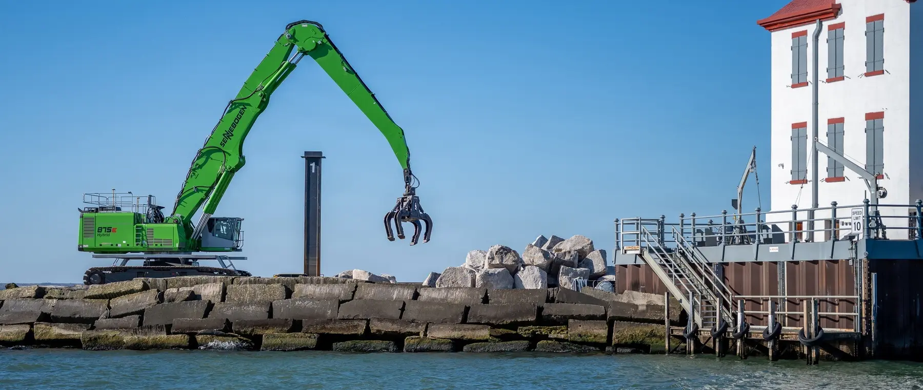
New photographs document work on Lake Erie
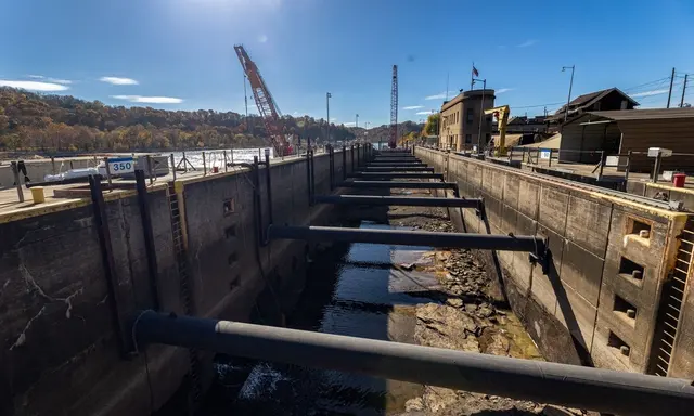
The Buffalo District of the United States Army Corps of Engineers released photographs on 9 November 2026 showing the placement of armour stone along the Lorain Harbour breakwater. Taken on 3 November, the images document a continuing effort to restore the protective structure that shelters the Ohio harbour and its navigation approaches. The structural repair programme is part of a federally funded multi-year plan announced in April. In parallel, a separate channel-dredging contract was completed in September. The latest photographs do not establish that the breakwater works are finished, but they provide a clear indication of engineering activity at a harbour used by both commercial and recreational vessels.
For owners of sailing and motor yachts between twelve and twenty-four metres, the story matters because the quality of coastal infrastructure is part of the cruising experience. A harbour entrance exposed to Lake Erie conditions cannot be judged solely by the appearance of its marina accommodation. The characteristics of its breakwaters, the condition of its channels, the traffic using the port and the work taking place around the entrance collectively influence whether a visit can be comfortably incorporated into an itinerary.
Repairing an existing protective structure
The Corps announced in April that deterioration associated with waves, ice and storms had impaired the western breakwater. Its repair programme is intended to restore the height of nearly the entire 2,812-foot structure. The public project account describes an approach in which new rubble-mound stone is placed over the existing stone construction from the lake side.
The term armour stone identifies the outer protective material used to resist the action of waves. It differs in purpose from the smaller material that may be used to build the supporting layers within a breakwater. The photographed activity concerns the placement of the larger material, rather than an entirely new harbour entrance being created elsewhere. Its durability depends on the completed geometry, the selection and placement of the stone and the behaviour of the foundation. It would be inappropriate to infer the design performance of the whole structure or the exact length remaining to be repaired from a single photograph. Those details belong to the responsible engineers and subsequent inspections. The images are useful evidence of physical work, not a certificate of completion.
A phased investment in the harbour
The April announcement identifies the work as part of a $20.5 million multi-year programme. Its publicly described first phase was undertaken under a contract of approximately $10.2 million awarded in August 2024 to Great Lakes Dock and Materials. The second phase, under another approximately $10.2 million contract awarded to Dean Marine and Excavating in March 2026, addresses approximately 1,750 feet nearer the shore.
The stated expectation in April was that the first phase would finish in summer and the second would be completed by 2028. The Corps did not then announce the starting date of the latter phase. The November images document stone placement but do not establish the contractual stage associated with the operation, and should not be used to calculate revised completion dates. Repairs to the east and outer breakwaters were also targeted for 2027. These distinctions matter to visiting yachts, whose crews can consult current navigational information for the actual conditions rather than rely on a historical programme as if it were a schedule of unrestricted access.
Protecting the approach rather than guaranteeing conditions inside
A breakwater changes the way waves move towards the water beyond it. Its effectiveness depends on its particular configuration, the height and direction of incoming waves and the geometry of the harbour. It can reduce the exposure of an area of water without eliminating every disturbance generated by wind, currents or movements of vessels. The November work is directed at preserving the protective function of an established structure.
A yacht skipper planning to arrive after a passage on Lake Erie should consider the actual anticipated conditions on the approach and in the harbour, including the suitability of the intended berth. The fact that a harbour has a substantial breakwater does not establish that any approach is appropriate in every weather condition. Crew members unfamiliar with the location should consult the latest official charts, weather information and local restrictions. Communications with the intended marina are particularly useful when an engineering operation affects the usual approach or when a yacht may arrive outside the operator's staffed hours. Such preparation is relevant even to yachts significantly smaller than the large vessels that the harbour is principally designed to serve.
The historic lighthouse and the working waterfront
The western breakwater also supports the historic Lorain Lighthouse, a landmark more than a century old. The Corps refers to the lighthouse in its November photographic captions, illustrating the way an engineered protective structure can acquire additional historical and cultural significance. A lighthouse associated with a commercial harbour may be of interest to a visiting yacht owner both as a feature of the waterfront and as evidence of the region's maritime development.
Its appearance should not be confused with confirmation of the status of any navigational aid. A skipper should use official information about lights and navigational marks rather than infer their characteristics from a historic photograph. The same distinction extends to visiting the structure itself. The presence of an attractive landmark does not confer permission to approach or land at an industrial or construction site. Guests interested in its history can arrange a legitimate shore-based experience, separately from the yacht's navigational movements. This is particularly important while heavy equipment is operating around the supporting breakwater.
The separate autumn channel-dredging operation
The Corps confirmed in late September that dredging under a $2.5 million contract had removed approximately 45,000 cubic yards of material at Lorain. The operation ran from 15 to 22 September, and the removed sediment was delivered to a local recycling facility for beneficial use. It concerned the federal navigation channel extending from the harbour entrance towards the river docks. It was distinct from the structural work photographed in November.
The announcement identifies authorised channel depths ranging from 17 to 29 feet depending on the part of the harbour. Those figures are not a survey of every possible berth, approach outside the maintained channel or position alongside a private facility. The distinction between a project's authorised dimensions and the conditions encountered by a particular vessel is especially important when the recent depth information is unavailable to a visiting skipper. Appropriate allowances for the yacht's draught, water levels and other relevant circumstances should form part of the passage planning process. The completed dredging contract does not eliminate subsequent changes in sediment distribution.
Passing an active marine construction site
The April project announcement describes works conducted from a marine barge and asks vessels to take particular care near the breakwater. The latest official images show the continuing scale of stone placement. A working barge may be accompanied by service vessels and equipment whose positions change as successive areas are addressed. The local requirements applying to navigation around the work should therefore be established before a visit.
For a luxury yacht's crew, the priority should remain the navigation of the vessel rather than obtaining a closer view of the operation. Taking photographs, briefing guests and organising transfers should not distract from the skipper's responsibilities. A marina operator or harbour representative can help identify practical local considerations, but the current official notices and applicable navigation rules remain essential. A captain should not assume that the absence of a clearly visible work platform from one direction signifies the end of construction. The work area and access arrangements can change during an individual day.
Incorporating Lorain into a wider Lake Erie programme
A coastal itinerary built around several Great Lakes destinations can benefit from understanding infrastructure projects alongside the availability of shore facilities. Lorain's November images show why the work performed outside marina basins can be relevant to the owners using them. The ability to reach a berth reliably depends on conditions across a wider system of protective structures and channels.
An owner considering a visit should confirm the intended marina's seasonal operation, approach, facilities and any relevant restrictions with its operator. This is especially important during the autumn and winter period when the availability of services may differ from that during the principal cruising season. No specific marina availability or completion status is established by the Corps' work photographs. The evidence released this month confirms the placement of stone on the breakwater on 3 November, while the April project documentation supplies the broader engineering and contractual context. It is precisely that combination of dated observations and clearly defined scope that makes the latest update useful for the yachting community.
Sources and photograph
Source documentation: https://www.dvidshub.net/image/10083697/lorain-breakwater-repair-stone-placement, https://www.dvidshub.net/news/563921/corps-engineers-beginning-critical-repairs-lorain-harbor, https://www.army.mil/article/295698/lorain_harbor_dredging_completed_in_just_over_a_week. Photograph: Armour stone placement at Lorain Harbour, 3 November 2026 — U.S. Army photo by Andre’ M. Hampton, USACE Buffalo District / DVIDS, 3 November 2026; public domain.. Official public-domain U.S. Army photograph, credited to the named photographer; The appearance of U.S. Department of War (DoW) visual information does not imply or constitute DoW endorsement. See DVIDS copyright information.