A November advisory with particular relevance to larger yachts
NOAA Fisheries has listed a temporary whale slow zone covering Cape Cod Bay and surrounding waters in Massachusetts from 2 to 17 November 2026. The federal agency encourages vessel operators to avoid the area or reduce their speed to no more than 10 knots when passing through it. The designation is a voluntary measure, distinct from the mandatory seasonal speed limits applicable to most vessels of 65 feet or more in specified waters at specified times. As of 15 November, the published end date of the temporary zone is two days away. Captains should check the current notice before every passage, including after that date, since the presence of whales and the status of protective zones can change. The announcement coincides with the start of the winter migration and calving season along the US Atlantic coast. This is a matter of direct relevance to owners in the larger part of Luxury Yacht Guide's size category, rather than simply an issue for commercial ships or superyachts. A vessel measuring 65 feet falls well within the upper part of the luxury yacht market.
Understanding the geography without relying on a screenshot
The temporary zone is described by NOAA using a rectangle with northern and southern limits of 42 degrees 10 minutes north and 41 degrees 40 minutes north, and eastern and western limits of 69 degrees 59 minutes west and 70 degrees 40 minutes west. Those coordinates explain the geographical extent of the published advisory; the official current chart and coordinates remain the appropriate references for route planning. A skipper should establish whether the entire voyage passes through the area, rather than merely checking the position of the destination marina. A yacht travelling along the outer coast and a yacht entering the bay may encounter quite different operating conditions even if both are heading towards Massachusetts. The limits of a temporary slow zone must also be distinguished from the boundaries of a seasonal management area. NOAA publishes each separately. A navigation system that displays one class of area is not necessarily showing the other in its latest form. The status of the temporary designation is therefore something to confirm against the agency's active advisory before sailing.
Which yachts are affected by the federal rule?
NOAA's federal seasonal programme applies in designated areas to most vessels of 65 feet or greater, with a maximum permitted speed of 10 knots while the relevant seasonal restrictions are in effect. In metric terms, the threshold is about 19.8 metres. A substantial number of cruising yachts toward the upper end of the 12–23.99-metre category can meet that threshold. Operators should confirm the legally relevant length measurement and any applicable exception using the actual regulation and their vessel documentation, rather than rely on an informal model designation. A yacht marketed with a number in its name is not necessarily exactly that many feet long. For vessels below the federal threshold NOAA strongly encourages the same speed reduction in the affected areas, and other requirements can apply under state law. The temporary November advisory itself is voluntary. It must not be described as a new federal prohibition on all vessels throughout Cape Cod Bay. That distinction matters both to compliance planning and to clear communication between an owner, skipper and crew.
The winter migration extends the issue beyond Massachusetts
NOAA identifies seasonal areas along the migratory route and in the southeastern calving grounds that become active on 1 November and generally remain in effect until 30 April. The listed locations include waters near the entrance to the ports of New York and New Jersey, Delaware Bay, Chesapeake Bay and Morehead City and Beaufort in North Carolina, as well as specified stretches along the southeastern US coastline. The precise geographic boundaries vary. The federal Cape Cod Bay seasonal area has a different calendar, beginning 1 January and continuing through 15 May. Massachusetts also has a separate state speed regime for smaller vessels in Cape Cod Bay during its specified spring period. An owner moving a yacht from New England to a winter base in Florida should therefore consider the entire route and the timing of individual passages. Avoid mistaking the expiry of the November temporary slow zone for the end of all whale-related navigational measures on the Atlantic coast. Check the applicable local and federal requirements near every relevant port as the itinerary develops.
Why speed changes are an operational decision
Right whales frequently occupy the surface layer of the ocean and can be extremely difficult to detect from a moving vessel. Their shape and coloration offer few obvious visual cues compared with some other whale species. Reduced visibility, low-angle light, waves and spray can further impair detection. At a fast cruising speed, a watchkeeper has a much shorter period in which to recognise a potential animal in the vessel's path and decide on an appropriate response. NOAA promotes lower speeds as a means of reducing collision risks and the severity of injuries when collisions occur. It also recommends keeping watch and avoiding areas of whale presence where practical. This is not an assurance that a yacht moving slowly cannot strike a marine mammal. It is one component of risk reduction. Bridge procedures should reflect the possibility that an animal may be present without broadcasting a signal or leaving a conspicuous mark on a radar display. A crew must not assume that a warning system makes a continuous lookout unnecessary.
Incorporating the restrictions into passage planning
For a performance motor yacht, the distinction between an unrestricted cruising leg and an area requiring displacement-speed operation can alter a timetable significantly. A skipper should establish safe, compliant speed profiles on the charted route and make appropriate allowance for the corresponding duration, weather window, fuel plan and arrival arrangements. The manufacturer's published fuel economy at a particular cruising speed is not a substitute for an estimate based on actual sea state, vessel displacement and engine load. An itinerary built around a preferred high-speed crossing may require a different departure time when it intersects a live restricted area. It may sometimes be possible to choose a route outside the area, but such a choice must be evaluated against navigational safety, prevailing conditions and the latest whale information. Simply adding distance to avoid a restriction without reviewing water depth, coastal hazards and the yacht's endurance is not a sound plan. The owner should be informed early of any change to the voyage schedule rather than placing the skipper under pressure to recover time through unsafe speed.
What the 2027 calving season announcement adds
NOAA's newly published calving season information records the first identified calf of the season, reported with the female right whale known as Curlew off St Augustine Inlet, Florida, on 10 November. That report is separate from the Cape Cod advisory and does not establish that the same animals were responsible for the northern slow-zone designation. It is nevertheless an important reminder that the seasonal movement of whales is underway. Many travel south from feeding areas farther north, and mothers with young calves spend time near the surface. A yacht travelling to a southeastern winter destination may therefore encounter wildlife exposure quite different from that familiar to its crew during summer cruising. Visits to protected marine environments should be planned around the responsible authorities' rules, including restrictions on approaching whales. A marine mammal sighting is not an invitation to alter course towards it or launch a drone. Any reporting or observation must be undertaken safely and consistently with local requirements.
Use authoritative updates, not a static itinerary
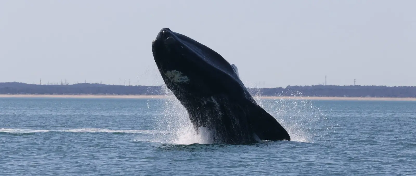
NOAA provides current zone listings and links to whale-sighting advisory systems. Operators can also receive notifications and use the Whale Alert application, but a supplementary alert should form part of a wider process that includes current charts, navigation warnings and watchkeeping. For a charter operation, briefing documents can identify the designated speed areas and explain why the departure or arrival schedule may need to change. For a privately operated yacht, the same information may be kept with the skipper's passage plan. Record the source and time at which restrictions were checked, especially when conditions are changing or a passage straddles the start or end date of a designation. A reported end date is not a guarantee that no replacement advisory will be issued. The photograph accompanying this article is an official NOAA archive image from Cape Cod Bay, published in 2021; it does not depict a whale sighting during the November 2026 zone. The present news is the advisory published by NOAA and the seasonal measures that remain relevant to luxury yacht operators. Verify the live official instructions before departure.
Sources and photograph
Source documentation: https://www.fisheries.noaa.gov/national/endangered-species-conservation/reducing-vessel-strikes-north-atlantic-right-whales, https://www.fisheries.noaa.gov/national/endangered-species-conservation/north-atlantic-right-whale-calving-season-2027, https://www.fisheries.noaa.gov/feature-story/north-atlantic-right-whales-move-northeast. Photograph: North Atlantic right whale surfacing in Cape Cod Bay (2021 archive photograph) — NOAA Fisheries/Alison Ogilvie; official archive photograph published 15 April 2021, used under NOAA Fisheries' website photo policy. Official NOAA archive photograph, not a November 2026 sighting; credit and reuse under NOAA Fisheries photo policy. Reproduction does not imply NOAA endorsement.