The 2026 result and what it actually measures
The Balearic Government has reported its lowest recorded share of checked anchorages affecting Posidonia oceanica since its dedicated surveillance service began in 2018. In a statement dated 4 November 2026, the regional environment department said anchors or chains were found over seagrass at four per cent of the anchorages inspected during the 2026 season. That is a meaningful result for the yacht community, because the measurement concerns the physical placement of anchoring equipment rather than an abstract pledge to improve behaviour. It does not mean only four per cent of all boats in Balearic waters caused an impact: the denominator is the inspections the service actually carried out. Nor is it proof that underwater ecosystems have already recovered. It is evidence that a preventable pressure on a vulnerable habitat was recorded less frequently in the monitored population.
The figures behind the headline
Government figures show that the 2026 surveillance season ran from 15 May until 10 October. During that period the Posidonia Surveillance Service, operated through IBANAT, recorded 154,335 activities. Within that overall total it checked 137,685 anchorages, provided information to 6,213 boats and assisted 4,927 vessels with anchoring manoeuvres. Officers identified 5,510 cases where an anchor or its chain was placed on seagrass and asked the vessel concerned to relocate to sand. This last figure is a count of identified situations requiring corrective action, not a tally of fines, proven environmental damage or individual boat owners. Reading those categories accurately matters. A busy service can report many interventions precisely because it is helping skippers avoid damage before that damage becomes entrenched. The published figures provide a useful account of operational activity but cannot substitute for a full ecological assessment.
Eight years of change, with a note of caution
The comparison with earlier seasons makes the result notable. The Balearic department puts the corresponding 2018 share at 17.3 per cent and the 2025 share at 6.4 per cent, against four per cent in 2026. Those are the service’s reported percentages and should be read as observations from its monitoring system, rather than as a controlled experiment proving that any single intervention caused the improvement. Weather, cruising patterns, vessel numbers, the locations inspected and patrol resources can change between years. Nevertheless, the direction reported across this period supports the practical case for making seagrass awareness a routine part of yacht operations. In the luxury-yacht sector, where shore teams can arrange a berth or permitted mooring in advance, there is little reason to leave seabed choice to the last few minutes of a crowded arrival.
Why a chain matters as much as an anchor
The government's advice focuses on a frequently overlooked detail: a vessel can place its anchor in sand and still bring its chain into contact with the protected plants. A swinging yacht may shift the loaded portion of the rode across the bottom as the wind or current changes. That makes the final footprint of the whole anchoring arrangement important, not simply the point where the anchor initially lands. Owners of 12-to-24-metre yachts need to apply particular care because heavier ground tackle and the forces involved can make a casual anchoring choice consequential. A sound approach is to consult official habitat mapping, assess the whole swing circle, use the right amount of scope for the conditions and leave enough clearance that the rode is unlikely to sweep into vegetation. It is equally sensible to choose a managed berth when the available sandy patch is marginal.
Different islands show different results
The regional government reported a varied picture around the archipelago. Formentera had the lowest share in its published island figures, at 1.5 per cent. Mallorca was reported at 5.2 per cent and Menorca at 3.8 per cent, while Ibiza stood at ten per cent after a fall from 21.3 per cent the previous year. These percentages should not be turned into a simplistic league table of visiting skippers. Each island has a different coastline, habitat distribution, anchoring demand and inspection pattern. The more useful editorial conclusion is that local conditions matter. A cruising yacht that has found an acceptable anchorage on one island cannot assume the same practice will be suitable elsewhere. Planning should be bay-specific and guided by current information from the competent authority, rather than by an old waypoint shared casually between crews.
What the new Posidonia 2030 project adds
Two days after reporting the season's outcome, the Balearic administration outlined a successor programme called Posidonia 2030. According to its announcement, the programme is intended to combine anchoring surveillance with scientific monitoring, data management, environmental education and international cooperation. The government also described a proposed transformation of its existing Posidonia telephone service into a coordination centre bringing together environmental officers, the Guardia Civil, port bodies and other institutions. The current surveillance contract concludes with the 2026 season, so the new programme is important as a statement of intended continuity. It should not be described as fully delivered infrastructure on the basis of an announcement. For boat owners and operators, the practical value will depend on how clearly the new arrangement publishes information and how consistently its services are available when the summer fleet returns.
A better pre-arrival briefing for luxury yachts
The figures underline the value of a detailed pre-arrival briefing. Before departure, an owner, captain or charter manager can check the destination's official charts and habitat guidance, identify where a booked marina berth or authorised mooring is available, and establish a backup if local winds make a selected anchorage unsuitable. A useful briefing goes beyond the name of a fashionable cala. It records the proposed approach, expected traffic, draft constraints, likely overnight exposure and the local authority's contact route. It should also make clear that a beautiful aerial photograph does not establish permission to anchor. Guests choosing between a quiet anchorage and a marina deserve an explanation that links comfort, privacy and environmental care. The best decision is often made before anyone has even seen the bay.
Charter operators have an unusually direct role
A private owner may return to a favourite anchorage several times a season; a charter yacht can introduce a new group of guests every week. That gives charter operators an opportunity to explain what responsible anchoring actually looks like. A short briefing about why the yacht is using a buoy, relocating to sand or choosing a different lunch stop can turn a potential disappointment into a valuable part of the holiday. The message need not be stern or technical. It can be framed as care for the clear water and living seabed that make the Balearics attractive. Shore-side brokers can also help by matching itineraries to available, appropriate berths and realistic transit times. Such planning is good service as well as good environmental practice: it reduces rushed decisions at the end of an already long day's passage.
How to interpret surveillance without overstating it
There is a difference between a checked anchorage, an intervention and a biological outcome. The 5,510 situations flagged by the service indicate equipment found over seagrass at the time of inspection, with requests to move. They do not tell readers the exact area disturbed, the duration of contact or the rate at which plants may recover. Equally, the decrease in the proportion detected should not be dismissed because it is a procedural measure. Preventing contact is an immediate, tangible objective of patrols and education. A responsible industry publication should welcome that improvement while continuing to ask for comparable statistics and independent information about habitat condition. In that sense the announced emphasis on scientific monitoring under Posidonia 2030 is a potentially useful complement to the patrol figures, provided future results are made accessible and clearly explained.
What visiting skippers should do now
The immediate operating lesson is straightforward even though the navigation details differ by bay. Use current official habitat maps, local notices and advice from the harbour or mooring authority; plan to anchor only on suitable, permitted substrate; and check both anchor and chain position wherever it is safe and practical to do so. Never treat a chartplotter colour alone as proof of bottom type or legal permission. Be prepared to reposition promptly if an authorised patrol identifies an issue. For an overnight stay, take changing conditions, swing room and the possibility of a crowded anchorage seriously. The Balearic Government's public information is a starting point for planning, but it is not a substitute for nautical charts, local regulations or the judgement of the person in command. The goal is a secure yacht and a seabed that remains intact after departure.
The wider message for Mediterranean cruising
The Balearic figures are relevant beyond the islands because the underlying challenge is shared across Mediterranean destinations: a desirable anchorage can be a living habitat as well as a place to spend an afternoon. The response therefore requires more than environmental slogans. Mooring infrastructure, clear mapping, consistent advice, trained crews and practical alternatives all affect what happens when a yacht arrives. The 2026 results suggest that sustained attention to how boats anchor can coincide with a marked reduction in the proportion of problematic placements detected. They also show why a claim of total success would be premature. For luxury-yacht owners, the compelling standard is simpler and more demanding: a memorable visit should leave the coast as beautiful below the waterline as it appeared from the deck.
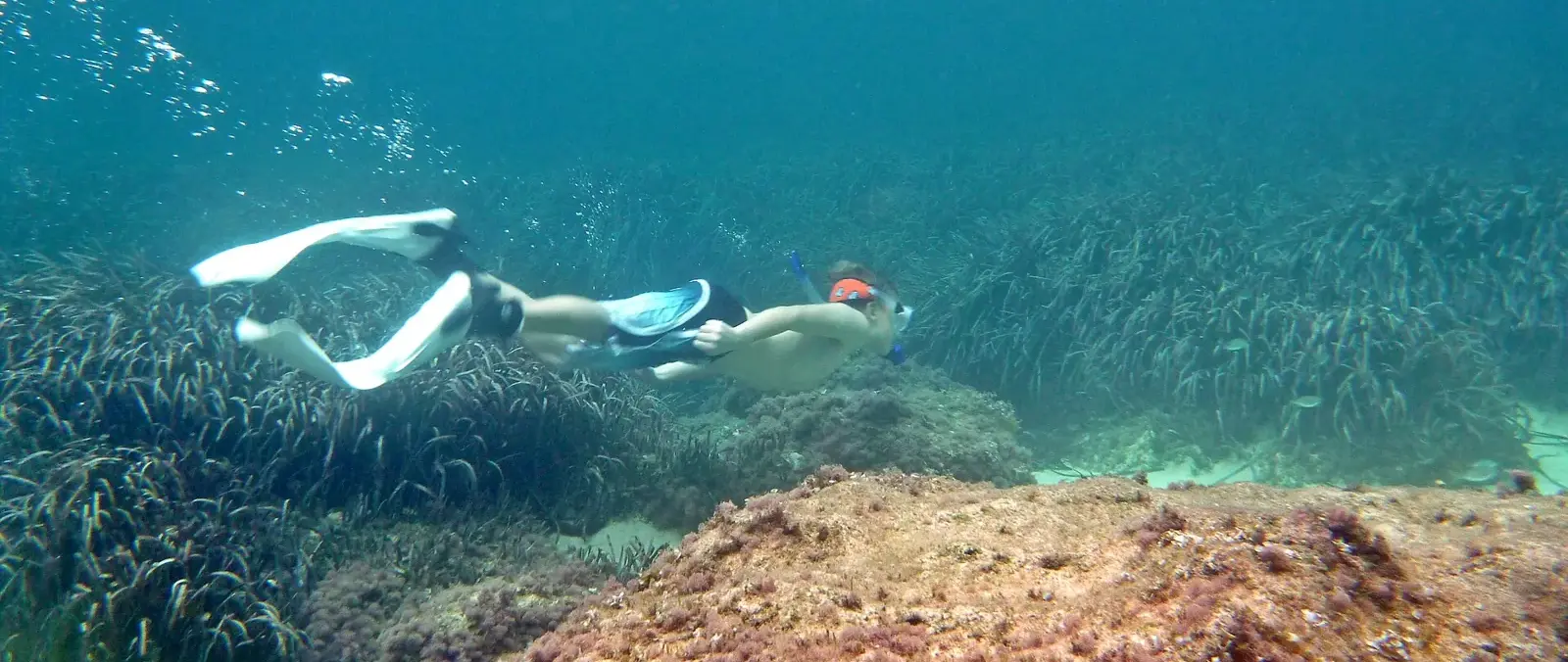
Photograph: A snorkeller above a Mediterranean seagrass meadow near Mallorca, photographed by Wusel007 on 15 October 2013. Wikimedia Commons, CC BY-SA 3.0; resized and converted to WebP. Archival illustration, not a 2026 surveillance photograph.