A different side of the Costa Smeralda
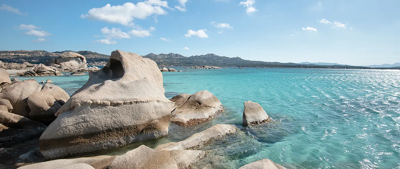
The La Maddalena archipelago is a compelling counterpoint to the more conspicuous marinas of northern Sardinia. Granite islands, translucent water and a succession of small channels reward a luxury-yacht itinerary built around unhurried discovery, but the archipelago is also a national park where the most beautiful inlet may be subject to the strictest protections.
A visit should begin with a clear distinction between a yacht's ability to reach an anchorage and its legal right to use it. Park authorisations, protected seagrass, locally marked zones and seasonal maritime orders affect where vessels can travel, stop, deploy tenders and put guests ashore.
That complexity does not diminish the attraction of the islands. It helps distinguish a carefully planned private voyage from a hurried cruise that treats every beach as open access, and it gives a professional captain useful opportunities to show how comfort and environmental stewardship can fit together.
The islands worth understanding before arrival
La Maddalena is the archipelago's inhabited centre and a natural reference point for provisions, restaurants and town life. It offers a civilised contrast to the waterborne part of the itinerary, with time ashore better arranged through a suitable recognised port or landing rather than an improvised beach transfer.
Caprera has a wilder character, combining granite formations, maritime vegetation and walking routes that reveal the islands from above. The national park publishes visitor information for Caprera's trails and regulates access to especially sensitive places such as Cala Coticcio and Cala Brigantina, so shore visits require the same degree of planning as yacht movements.
Spargi and Santa Maria are often associated with luminous shallows and lovely views across the channels. Their appeal is strongest when guests can enjoy the changing water colours from permitted positions without imposing on fragile beaches or trying to find a private landing at every scenic stop.
Budelli's famous Pink Beach is an especially clear example of the difference between viewing and access. The park maintains specific protections for Spiaggia Rosa, and a respectful yacht programme treats this extraordinary shoreline as a conservation subject rather than a private beach club.
Permits come before the anchor goes down
The national park's English-language guidance explains that the relevant permit, or ticket, allows qualifying visitors to navigate, moor and anchor within 300 metres of the coast subject to the park's rules. Its published advice is to arrange authorisation before entering protected waters, since enforcement can lead to penalties and additional charges when a vessel lacks the appropriate approval.
Private owners and charter operators should not assume that their paperwork is interchangeable. The park distinguishes between non-resident private leisure use, occasional chartering, commercial rental and other activities, with separate applications and conditions that agents must resolve against the actual vessel and use.
Payment routes and tariff schedules can also change, so the captain or agent should work from the official park authorisation platform and current published instructions. A permit is not a blanket right to anchor anywhere in the national park, and it cannot override conservation closures or harbour-master orders.
What the 2026 navigation order means
In April 2026 the La Maddalena Harbour Master's Office issued Ordinance 33/2026, with experimental seasonal provisions for the summers of both 2026 and 2027. The park's explanation specifies that these particular seasonal measures apply from 1 June to 30 September of each year, so they must not be confused with all-year park rules.
During that seasonal period, the reported speed limit is seven knots within 500 metres of shore and 10 knots between 500 and 1,000 metres, with displacement-mode operation required in the latter band. A yacht leaving the dock should have the order and its geographical annexes on the bridge, since a convenient distance estimate from a chartplotter is not a substitute for identifying an actual restricted zone.
The order also protects designated transit corridors for emergency vessels and sets operating conditions for mooring fields and passenger vessels. Captains should follow the full official text and current local navigation notices, because an abbreviated summary cannot identify every corridor, priority area or exception relevant to a particular itinerary.
Posidonia is the most important invisible boundary
The Mediterranean seagrass Posidonia oceanica is a protected habitat that can be difficult to distinguish from a casually viewed anchorage chart. The 2026 order prohibits anchoring over Posidonia meadows and other sensitive habitats, allowing it only on appropriate sandy or muddy seabed where the other applicable rules permit.
Responsible anchoring therefore begins well before the crew deploys the windlass. The captain should verify the park zoning, seabed character, current permission and swinging room, then use an authorised mooring buoy where that offers the safer and less damaging choice.
This matters particularly on a larger charter yacht, where the anchor and length of chain can disturb an extensive area as the vessel moves. Guests may see an inviting pool of pale-blue water, but the crew's view must also include what lies below it and whether the vessel can remain there without harming the seabed.
Swimming, tenders and the quiet luxury of restraint
Clear water makes swimming an obvious pleasure, yet the park's designated mooring areas and passenger-traffic rules affect where people may enter the sea. The Harbour Master's seasonal guidance includes limited near-vessel bathing provisions at moorings, while tender movements and swimming close to commercial passenger manoeuvring areas demand particular care.
Some well-known coves, including Cala Corsara, Cala Coticcio and Spiaggia dei Cavalieri, are identified in the order as places with priority water areas for passenger-vessel manoeuvres. A visiting yacht cannot treat such a location as an empty swimming pool merely because there appears to be room in the bay.
A refined itinerary may consequently favour an early start, carefully timed authorised mooring and an elegant lunch on board, with a local guide for any regulated shore excursion. The experience is stronger when its rhythm follows the environment rather than trying to fit the same ambitious beach list into every day.
Shore experience with local interpretation
Away from the wheelhouse, La Maddalena town offers an opportunity to reconnect with the island community and Sardinian food culture. The most meaningful visit is not necessarily the most expensive reservation but a well-paced evening ashore that supports local businesses and leaves the tender team with an agreed, lawful return plan.
Caprera is a natural choice for guests who want walking and interpretation alongside swimming and scenery. Because access to certain trails and coves can be controlled, agents should consult the park's current visitor information and use authorised environmental guides where required.
Small-group photography can be rewarding from approved paths and water viewpoints, while drones and other intrusive activities require separate regulatory checks and may be prohibited. The yacht's concierge should build a programme around what is actually permitted on the chosen date, rather than advertise private access that has not been secured.
A three-day itinerary shaped by the park
An achievable first day can centre on arrival, formalities and a La Maddalena town visit, keeping the guest programme light while the bridge team confirms permissions and operating boundaries. The evening can be dedicated to local dining and a briefing about why this island group is different from an unrestricted cruising coast.
On the second day, choose a modest passage among authorised island waters, with time to observe the granite formations, swim where permitted and enjoy the archipelago from the yacht. The crew should leave enough flexibility to change the planned mooring if weather, visitor traffic or conservation controls make the original location unsuitable.
A third day may combine a carefully arranged Caprera shore excursion with a slower return toward the northern Sardinian cruising circuit. The objective is not to tick off every beach, but to give guests a richer understanding of the islands, their natural resources and the protections that allow their beauty to endure.
Before you cast off
The most valuable documents for this voyage are the park's live authorisation rules, the Harbour Master's latest notices, the current protected-area maps and any guidance governing the vessel's specific charter or rental status. For a visit outside the June-to-September period, the seasonal 2026 order should still be understood historically while all-year park protections and any new notices are checked afresh.
The park's official information is explicit about restrictions on discharging waste and wastewater into the water and removing natural materials such as sand or shells. An experienced yacht operation will already have waste management procedures, but local compliance and proper disposal arrangements belong in the destination briefing rather than being treated as an afterthought.
La Maddalena is at its best when luxury means space, confidence and a sense of place. Captains who plan legal routes, safeguard Posidonia and leave protected shores undisturbed can offer guests the rare pleasure of seeing a much-loved Mediterranean archipelago on its own terms.